
Table of Contents
- What is Georgian Military Highway?
- How Georgian Military Highway Works
- Benefits and Use Cases
- Best Practices
- Related Concepts
- Final Thoughts on Traveling the Highway
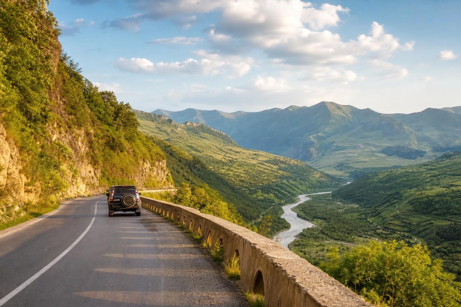
Few roads on Earth can match the drama of driving from Tbilisi to the Russian border through the heart of the Greater Caucasus. The route climbs through river gorges, passes medieval fortresses, and crosses a mountain pass at over 2,300 meters before descending into the volcanic highlands near Kazbegi. This is the Georgian Military Highway: a 212-kilometer stretch of road that has served as a lifeline between Europe and Asia for centuries, and one that remains Georgia’s most iconic driving experience in 2026. Whether you’re planning a road trip, researching Caucasus history, or just trying to figure out what all the Instagram photos are about, this guide covers everything you need to know.
What is Georgian Military Highway?
Definition
The Georgian Military Highway is a 212-kilometer (roughly 132-mile) road running north-south through Georgia, connecting the capital city of Tbilisi to the town of Vladikavkaz in Russia’s North Ossetia. The route follows the Aragvi and Terek river valleys, crossing the Greater Caucasus mountain range at the Jvari Pass (2,379 meters / 7,805 feet). Its official Georgian name is “Sakartvelos Samkhedro Gza,” though locals and travelers alike typically just call it the “military road” or refer to it by its destination: “the road to Kazbegi.”
The name “military” comes from its formal construction under Russian Imperial rule in the early 19th century. Russia needed a reliable supply route to its newly acquired territories in the South Caucasus, and between 1799 and 1863, engineers widened and paved what had been an ancient mountain trail. But the route itself is far older: travelers, traders, and armies have used this corridor through the Caucasus for at least 2,000 years.
Key Concepts
Understanding a few key reference points helps make sense of the highway and why it matters.
- Jvari Pass (Cross Pass): The highest point on the road and the crossing point of the Greater Caucasus watershed. Snow can close this pass between November and April, though Georgian road crews work aggressively to keep it open.
- Kazbegi (Stepantsminda): The main town near the northern end of the highway on the Georgian side, sitting at about 1,740 meters elevation. It serves as the base for visiting Gergeti Trinity Church and Mount Kazbek (5,047 m).
- Ananuri Fortress: A 16th-17th century castle complex roughly 70 km north of Tbilisi, overlooking the Zhinvali Reservoir. It’s typically the first major stop on the drive.
- Gudauri: Georgia’s premier ski resort, located at approximately 2,200 meters on the southern approach to the Jvari Pass.
The highway is not a limited-access motorway. It’s a two-lane mountain road with switchbacks, tunnels, and sections where livestock wander across the asphalt. That’s part of its charm, and also why the drive takes 3-4 hours one way rather than the 2 hours the distance alone might suggest.
How Georgian Military Highway Works
Core Mechanism
“How does a road work?” might sound like an odd question, but the military highway operates differently from most roads you’ve driven. The route functions as Georgia’s only reliable overland connection to Russia, and it doubles as the country’s most popular tourist corridor. These two roles create a unique dynamic.
Commercial trucks heading to and from Russia share the road with tourist minibuses, rental cars, and the occasional cyclist. During peak summer months (June through September), traffic can be significant, especially on weekends when Tbilisi residents head to the mountains. The Larsi border crossing at the northern end has been a bottleneck for years: wait times of 4-8 hours for vehicles are not uncommon during busy periods, though a new terminal expansion completed in late 2025 has improved throughput somewhat.
Weather is the road’s true governing force. The Jvari Pass regularly closes during heavy snowfall, and avalanche risk in winter is real. Georgian road authorities deploy snowplows and occasionally close the highway preemptively. I’ve personally seen the pass go from clear skies to zero visibility in under 30 minutes during shoulder season. If you’re planning a trip between November and March, always check road conditions the morning of your departure. The Georgian government’s road department posts updates, and local drivers are usually the best source of real-time information.
Components
The highway passes through several distinct geographic and cultural zones, each with its own character.
| Section | Distance from Tbilisi | Elevation | Notable Features |
|---|---|---|---|
| Mtskheta Junction | 20 km | 460 m | Ancient capital, Jvari Monastery |
| Zhinvali Reservoir | 55 km | 700 m | Turquoise reservoir, Ananuri Fortress |
| Gudauri | 120 km | 2,200 m | Ski resort, Russia-Georgia Friendship Monument |
| Jvari Pass | 135 km | 2,379 m | Highest point, Cross Pass |
| Stepantsminda (Kazbegi) | 155 km | 1,740 m | Gergeti Trinity Church, Mount Kazbek views |
| Larsi Border | 212 km | 1,200 m | Georgian-Russian border crossing |
The road surface quality varies. The stretch from Tbilisi to Gudauri is generally well-maintained asphalt. North of the Jvari Pass, conditions can deteriorate, particularly after winter or heavy rains. A significant tunnel project near the Jvari Pass has been under discussion for years to create an all-weather bypass, with construction phases ongoing as of 2026.
Benefits and Use Cases
Key Benefits
The highway offers something genuinely rare: world-class mountain scenery accessible without any hiking, special equipment, or expedition planning. You can leave a Tbilisi cafe after breakfast and be standing beneath 5,000-meter peaks by lunch. That accessibility is the road’s greatest asset.
For photographers, the route is a goldmine. The light shifts dramatically as you climb from the lowland river valleys into alpine terrain, and the variety of subjects – medieval churches, Soviet-era monuments, shepherds moving flocks across high pastures – means you won’t run out of material in a week of shooting.
The economic benefits for communities along the route are substantial. Towns like Stepantsminda have transformed from sleepy mountain villages into thriving tourism hubs. Guesthouse owners, restaurant operators, horse rental services, and 4×4 drivers who shuttle tourists up to Gergeti Trinity Church all depend on highway traffic. A night in a family-run guesthouse in Kazbegi typically runs 80-150 GEL ($28-52 USD) per person including homemade dinner and breakfast: a remarkable value for what you get.
Common Applications
People travel this road for very different reasons, and the experience changes accordingly.
Day trips from Tbilisi are the most common approach. Tour operators and shared minibuses (marshrutkas) run the route daily, with prices ranging from 25-40 GEL ($9-14 USD) for a marshrutka to 250-400 GEL ($87-140 USD) for a private driver. A typical day trip departs around 8 AM, stops at Ananuri and the Friendship Monument, reaches Kazbegi by midday, and returns to Tbilisi by evening.
Serious hikers use the highway as a gateway to multi-day treks. The Juta Valley, accessible via a side road near Stepantsminda, offers routes toward the Chaukhi Massif and Abudelauri Lakes. Mount Kazbek itself draws experienced mountaineers, with the standard route requiring 2-3 days from base camp and proper glacier equipment.
Winter visitors head primarily to Gudauri for skiing. The resort has expanded significantly in recent years, with lift ticket prices around 70-90 GEL ($24-31 USD) per day in the 2025-2026 season. The ski area sits right along the highway, making it one of the most accessible alpine resorts in the region.
Cyclists tackle the route too, though this requires serious fitness and comfort with sharing narrow mountain roads with trucks. The climb from the Aragvi valley to the Jvari Pass gains about 1,600 meters of elevation and is genuinely demanding. Most cyclists budget 2-3 days for the full route.
Best Practices
I’ve driven this road more times than I can count, and a few hard-learned lessons stand out.
Check the weather before you go, every single time. This sounds obvious, but the Caucasus mountains create their own weather systems. A sunny forecast for Tbilisi means nothing for conditions at the Jvari Pass. Local Telegram channels and the Meteocenter Georgia website provide the most current information. During winter months, call your guesthouse in Kazbegi before departing: they’ll know if the pass is open.
Leave Tbilisi early. By 10 AM on summer weekends, the road north of Zhinvali can get congested with tour buses. Departing by 7-8 AM gives you a much better experience and better light for photography at Ananuri.
Don’t skip the side stops. Most tourists rush straight to Kazbegi, but the Sno Valley and Truso Valley (both accessible via short detours off the main highway) are spectacular and far less crowded. The Truso Valley in particular, with its mineral springs and abandoned villages, is worth a half-day detour if you have a vehicle with decent clearance.
Hire a local driver if you’re not comfortable with mountain driving. The switchbacks north of Gudauri are steep, guardrails are inconsistent, and oncoming trucks don’t always stay in their lane. A local driver with a reliable SUV typically charges 200-350 GEL ($70-122 USD) for a full-day round trip from Tbilisi. Apps like Bolt work in Tbilisi but won’t help you in the mountains: arrange your driver in advance through your guesthouse or a local tour operator.
Bring cash. Card payment has improved in Kazbegi’s newer hotels and restaurants, but roadside stops, smaller guesthouses, and the 4×4 drivers at Gergeti still operate on cash. ATMs exist in Stepantsminda but aren’t always reliable.
Respect the altitude. The Jvari Pass sits above 2,300 meters, and Gergeti Trinity Church is at roughly 2,170 meters. Most people won’t experience serious altitude effects, but if you’re coming straight from sea level, take it easy on the hike up to the church. Bring water and sunscreen: the UV intensity at altitude is no joke, even on overcast days.
One more thing: if you’re crossing into Russia at Larsi, research current visa requirements and border wait times well in advance. The political situation between Georgia and Russia adds complexity, and this is a topic where local sensitivities run deep. Avoid casual political commentary with your hosts: Georgians have strong and varied feelings about their northern neighbor, and the 2008 war remains a raw subject.
Related Concepts
The military highway doesn’t exist in isolation. Several related routes and concepts help put it in context.
The Transcaucasian Highway (also called the South Ossetian road or the road through the Roki Tunnel) was historically another major north-south route through the Caucasus, but it passes through South Ossetia: a breakaway region that Georgia considers occupied territory. It’s effectively closed to regular civilian traffic and has been since 2008.
Georgia’s other famous mountain road, the route to Tusheti over the Abano Pass (2,926 meters), makes the military highway look like a gentle country lane. The Abano Pass road is unpaved, single-lane in many sections, and genuinely terrifying. It’s open only from June to October and requires a serious 4×4. If the military highway is your first Caucasus mountain driving experience, Tusheti is the graduate-level course.
The concept of “military roads” in the Caucasus extends beyond this single highway. Russia built several such routes during its 19th-century expansion, including the Ossetian Military Highway and the Sukhumi Military Highway. The Georgian route is simply the most famous and best-preserved.
For travelers interested in the broader Caucasus region, the military highway connects naturally with routes to Armenia (south through Tbilisi) and Azerbaijan (east). Many visitors combine a Kazbegi trip with time in Tbilisi’s Old Town, a visit to the cave city of Vardzia in southern Georgia, or wine tasting in the Kakheti region. Georgia is small enough that you can experience remarkably diverse landscapes within a single week.
The highway also holds significant literary and artistic importance. Alexander Pushkin, Mikhail Lermontov, and Alexandre Dumas all traveled and wrote about this route. Lermontov’s novel “A Hero of Our Time” draws heavily on the landscapes and culture of the military road. Standing at certain viewpoints along the highway, you can read passages from these writers and see essentially the same scene they described 150-200 years ago: the mountains haven’t changed, even if the road surface has.
Final Thoughts on Traveling the Highway
The road from Tbilisi to Kazbegi remains one of the most rewarding single-day journeys you can take anywhere in the world. It packs 2,000 years of history, genuine alpine grandeur, and authentic Georgian hospitality into a drive shorter than most American commuters cover in a week. The infrastructure has improved markedly over the past decade: better road surfaces, more accommodation options in Stepantsminda, and expanded services at Gudauri make the trip more comfortable than ever without stripping away the wild character that makes it special.
My honest recommendation: spend at least two nights in the Kazbegi area rather than doing a rushed day trip. Watch the clouds clear off Mount Kazbek at sunrise, hike to Gergeti Trinity Church in the golden hour before the tour buses arrive, and sit down to a proper supra dinner with your guesthouse hosts. The road itself is spectacular, but the mountains reward patience. Georgia’s most famous highway is best experienced slowly.