Navigating the Unique Landscape of Tbilisi and Georgia
Picture this: you've just landed at Tbilisi International Airport, excited to explore ancient monasteries perched on cliffsides, winding mountain roads leading to Kazbegi, and the chaotic charm of the capital city itself. Then reality hits. Street signs in an alphabet that looks like beautiful calligraphy but offers zero clues to pronunciation. One-way streets that seem to change direction based on local mood. And that rental car counter asking if you want GPS for an extra fee per day.
The question of whether to rent a car with GPS in Tbilisi isn't as straightforward as it might seem. Georgia presents a unique driving challenge that sits somewhere between European familiarity and complete navigation chaos. Your smartphone might be your constant companion at home, but will it serve you well on a mountain pass with no cell signal? Will the built-in GPS unit actually recognize that tiny village road leading to a 6th-century church?
I've watched countless travelers make both choices, and honestly, the right answer depends on where you're going, how comfortable you are with technology, and whether you're the type who finds getting lost charming or anxiety-inducing. Georgia rewards the adventurous driver with stunning scenery and hidden gems, but it also punishes the unprepared with dead ends, confusing intersections, and roads that exist on maps but barely exist in reality.
Let me break down everything you need to know before making this decision.
Complex Street Layouts and Alphabet Challenges
Tbilisi wasn't designed on a grid. The city grew organically over 1,500 years, spreading across hills, following the curves of the Mtkvari River, and expanding outward in ways that make logical sense only if you understand centuries of urban development. Streets twist, dead-end unexpectedly, and sometimes change names multiple times along a single route.
Then there's the Georgian alphabet. It's one of only 14 unique writing systems still in use worldwide, and unless you've studied it specifically, you won't be reading street signs. While major roads often include Latin transliterations, smaller streets in residential areas might only display Georgian script. As Klook notes, "While Tbilisi's streets can be intricate, modern rental cars are usually equipped with GPS navigation to assist you. This technology can be a lifesaver in a city where street signs may not always be in English."
The challenge compounds when you're trying to match what your navigation app shows against physical signage. Your phone might say "Rustaveli Avenue," but the street sign displays რუსთაველის გამზირი. Without some form of GPS guidance, you're essentially navigating blind, hoping the general direction feels right.
Traffic patterns add another layer of complexity. According to Georgia Today, starting January 1, 2025, distribution vehicles will face traffic restrictions during peak hours from 8:00 AM to 11:00 AM and 5:00 PM to 8:00 PM. This affects traffic flow significantly, and having real-time navigation that accounts for these restrictions becomes genuinely valuable.
The Difference Between City Driving and Rural Expeditions
Tbilisi driving and Georgian countryside driving are almost entirely different experiences. The city demands constant attention to aggressive drivers, unmarked lane changes, and pedestrians who cross wherever convenient. Rural Georgia requires attention to road conditions, livestock crossings, and routes that might not match current reality.
According to Georgia 4 You, speed limits in Georgia are 60 km/h in cities, 90 km/h on open roads, and 110 km/h on highways. These seem reasonable until you realize enforcement is inconsistent and local driving culture often ignores posted limits entirely. Navigation with speed camera alerts becomes genuinely useful here.
The further you venture from Tbilisi, the more GPS becomes essential rather than convenient. Roads to popular destinations like Kazbegi, Vardzia, or Svaneti involve mountain passes where wrong turns can cost hours. Some secondary roads marked on maps have deteriorated beyond practical use, and having navigation that shows alternative routes saves significant frustration.
| Driving Environment | GPS Necessity Level | Primary Challenge |
|---|---|---|
| Central Tbilisi | Moderate | Complex street layout, one-way systems |
| Tbilisi suburbs | High | Poor signage, residential maze |
| Major highways | Low | Straightforward routes |
| Mountain regions | Essential | Limited signage, road condition variability |
| Remote villages | Critical | Roads may not exist as mapped |
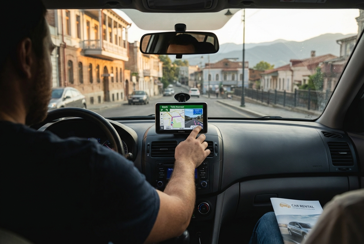
Built-in Car GPS vs. Smartphone Navigation
The rental counter decision often comes down to this: pay extra for the built-in unit or rely on your smartphone. Both have genuine advantages and frustrating limitations in the Georgian context.
Reliability of Local Maps and Real-Time Traffic
Built-in GPS units in rental cars typically run on systems like Garmin or TomTom with preloaded maps. The advantage is independence from cellular networks. The disadvantage is map currency. Georgian infrastructure changes faster than many GPS databases update, meaning new roads might not appear and closed routes might still show as viable.
Smartphone navigation apps generally offer more current mapping data because they update continuously. Google Maps has decent coverage of Georgia, but Yandex Maps often provides superior detail for this region. Real-time traffic data, however, requires consistent data connectivity, which brings its own challenges.
Rush hour in Tbilisi typically runs between 8-10 AM and 6-8 PM, according to OG.GE, with heavy traffic expected during these windows. Real-time traffic routing can save 20-30 minutes during peak congestion, but only if your device maintains a data connection. Built-in GPS units rarely offer live traffic updates in Georgia, making them less useful for city navigation during busy periods.
The practical reality is that neither option is perfect. Built-in units provide reliability without connectivity concerns but may have outdated information. Smartphone apps offer current data and traffic routing but depend on cellular coverage that becomes spotty outside urban areas.
Data Connectivity and SIM Card Considerations
Your smartphone's navigation capability in Georgia depends entirely on your data situation. International roaming works but often costs significantly more than local alternatives. Georgian SIM cards from providers like Magti, Geocell, or Beeline cost roughly 10-20 GEL (about $4-8 USD) with generous data packages.
The catch is coverage. Georgian cellular networks cover major roads and population centers well, but mountain regions and rural areas have significant dead zones. The road to Kazbegi, for instance, has stretches where you'll lose signal entirely. The route to Ushguli in Svaneti includes hours of driving with minimal connectivity.
This coverage reality makes offline maps essential regardless of whether you choose built-in GPS or smartphone navigation. Downloading offline regions before leaving Tbilisi isn't optional for rural exploration. It's mandatory.
A local SIM card offers another benefit beyond navigation: the ability to call for assistance if needed. Breaking down on a mountain road without phone service creates genuine safety concerns that a working local SIM helps address.
The Pros and Cons of Adding GPS to Your Rental
Rental companies in Tbilisi typically charge 5-15 GEL ($2-6 USD) per day for GPS units. Over a week-long rental, that adds 35-105 GEL to your total cost. Whether this represents good value depends on your specific circumstances and travel plans.
Cost Analysis of Daily Rental Fees
Let's break down the actual economics. A typical week-long car rental in Tbilisi runs 150-400 GEL ($55-150 USD) depending on vehicle type and company. Adding GPS at the average rate of 10 GEL per day adds 70 GEL, representing a 17-45% increase in total rental cost.
For that cost, you get a dedicated device with preloaded maps, a mount already positioned for easy viewing, and no drain on your phone battery. Many rental cars from Local Rent include comprehensive insurance at no extra cost, according to Trip Wis, but GPS typically remains a separate add-on.
The smartphone alternative costs whatever you pay for a local SIM (10-20 GEL one-time) plus potentially a car phone mount (20-40 GEL if you don't bring one). For trips longer than a few days, the smartphone approach usually costs less overall while providing more current navigation data.
| Cost Factor | Built-in GPS | Smartphone Navigation |
|---|---|---|
| Daily fee | 5-15 GEL | None |
| Weekly total | 35-105 GEL | 10-20 GEL (SIM only) |
| Equipment needed | Included | Phone mount (20-40 GEL) |
| Data costs | None | Included in SIM package |
| Map updates | May be outdated | Continuous |
Battery Preservation and Device Stability
Here's where built-in GPS genuinely shines: it doesn't drain your phone battery. Navigation apps are notorious power consumers, and running GPS continuously while driving can deplete even large phone batteries within a few hours. If your rental car has USB charging ports, this matters less. Many older rental vehicles in Georgia, however, may only have cigarette lighter adapters, requiring you to bring your own charging cable and adapter.
Device stability matters too. Built-in GPS units are designed for vehicle use, mounted securely, and optimized for the vibration and temperature variations of driving. Smartphones can overheat in direct sunlight on a dashboard, and a phone mount that seemed secure in the parking lot might vibrate loose on Georgian mountain roads.
The reliability factor extends to the device itself. Your smartphone handles communication, photography, translation, and entertainment in addition to navigation. If it fails or runs out of battery, you lose everything. A dedicated GPS unit failing only affects navigation, leaving your phone available for emergency calls or finding alternative solutions.
Top Navigation Apps for Driving in Georgia
Assuming you decide to rely on smartphone navigation, app selection matters significantly. Not all mapping services treat Georgia equally, and the differences become apparent quickly once you leave Tbilisi.
Why Yandex Maps Often Beats Google Maps Locally
Google Maps works adequately in Georgia but often lacks the detail that Yandex Maps provides. This makes sense geographically: Yandex is a Russian company that historically focused on the Caucasus region, while Google prioritized Western markets. The result is Yandex having more comprehensive coverage of smaller roads, more accurate business listings, and better understanding of local traffic patterns.
Yandex Maps shows marshrutka (minibus) routes, which helps when navigating around public transit traffic. It also tends to have more current information about road closures, construction, and temporary restrictions. The interface is available in English, though some local business names may display in Georgian or Russian.
Google Maps has advantages too: better integration with other Google services, more intuitive interface for most Western users, and superior satellite imagery. For major routes and tourist destinations, Google Maps performs perfectly well. The difference becomes noticeable when you're trying to find that specific guesthouse in a small village or navigate through Tbilisi's older neighborhoods.
Waze, owned by Google, offers another option with strong crowd-sourced traffic data. However, the user base in Georgia is smaller than in Western countries, reducing the accuracy of real-time traffic reports outside Tbilisi.
Using Offline Maps for Remote Regions like Kazbegi
Offline maps aren't optional for Georgian road trips. They're essential. The route to Kazbegi along the Georgian Military Highway is one of the country's most popular drives, yet cellular coverage drops out repeatedly along the way. Without offline maps downloaded, you'll find yourself staring at a blank screen exactly when you need navigation most.
Google Maps allows downloading specific regions for offline use. Before leaving Tbilisi, download the entire area you plan to visit. For Kazbegi trips, download the Mtskheta-Mtianeti region. For Svaneti, grab the entire Samegrelo-Zemo Svaneti region. These downloads can be large, so use hotel WiFi rather than cellular data.
Maps.me is another excellent option specifically designed for offline use. The app uses OpenStreetMap data, which often includes hiking trails and minor roads that other apps miss. For travelers planning to combine driving with hiking, Maps.me provides valuable supplementary information.
Remember that offline maps don't include real-time traffic data, so they're best for rural areas where traffic isn't a significant factor anyway. In Tbilisi, online navigation with traffic routing remains preferable when connectivity allows.
Safety and Practical Tips for Foreign Drivers
Georgian driving culture takes some adjustment. Locals drive assertively, lane markings are suggestions rather than rules, and the horn serves as a multi-purpose communication device. Understanding local practices helps you stay safe regardless of your navigation method.
Winter driving requires specific preparation. According to Georgia 4 You, winter tires are mandatory in Georgia from December 1 to March 1 in icy or snowy conditions. Mountain passes like the Jvari Pass on the Kazbegi route may close entirely during severe weather. Check road conditions before attempting mountain drives in winter, and ensure your rental car has appropriate tires.
Speed cameras exist throughout Georgia, particularly on major highways. Some navigation apps show camera locations, which helps avoid unintentional violations. Fines for speeding can be paid online, but the process is simpler to avoid entirely by staying within limits.
Fuel stations are plentiful along major routes but become scarce in remote areas. Before heading into mountain regions, fill your tank completely. The stretch between Mestia and Ushguli in Svaneti, for example, has no fuel stations for the entire route.
Police checkpoints are common, particularly near conflict zones like South Ossetia. Always carry your passport, driver's license, and rental agreement. Officers rarely speak English but are generally professional and courteous with tourists. Having your documents readily accessible speeds these interactions.
Parking in Tbilisi can be challenging. The city has paid parking zones marked with blue lines, and parking apps like TBilisi Parking allow payment via smartphone. Navigation to a destination doesn't help if you can't find parking nearby, so factor parking availability into your route planning.
Night driving outside cities requires extra caution. Road lighting is minimal, livestock may be on roadways, and pedestrians in dark clothing are common. Reduce speed significantly after dark, especially on rural routes.
Final Verdict: Is the Extra Cost Worth It?
The decision about renting a car with GPS in Tbilisi ultimately depends on three factors: your itinerary, your tech comfort level, and your tolerance for preparation.
If you're staying primarily in Tbilisi and visiting nearby attractions with good cellular coverage, skip the rental GPS. Download offline maps to your smartphone, pick up a local SIM card for 15 GEL, and use Yandex Maps for navigation. You'll have more current mapping data, real-time traffic routing, and spend less money overall.
If you're planning extensive rural exploration, particularly to mountain regions like Svaneti, Tusheti, or remote areas of Kakheti, the built-in GPS provides valuable backup. Cellular dead zones are real, and having a dedicated navigation device that doesn't depend on connectivity adds genuine peace of mind. The extra 50-100 GEL over a week seems reasonable insurance against getting seriously lost in areas where asking directions isn't always possible.
For most travelers, a hybrid approach works best. Rely primarily on smartphone navigation with offline maps downloaded, but consider the rental GPS as backup for remote adventures. The smartphone handles city navigation with traffic routing while the GPS provides reliability when connectivity fails.
Whatever you choose, don't underestimate Georgian roads. They reward preparation and punish overconfidence. Download those offline maps before leaving your hotel. Know your route before starting the car. And embrace the reality that getting slightly lost in Georgia often leads to the best discoveries: unexpected viewpoints, friendly locals pointing you in the right direction, and stories you'll tell long after the trip ends.
The GPS question matters less than the willingness to explore. Georgia's roads lead to extraordinary places. Make sure you can find your way there, and more importantly, find your way back.